DroneTower
Mobile access to the PansaUTM system is provided by the DroneTower app which is available for Android and iOS devices.
Pursuant to Article 156a(2) of the Act of July 3, 2002—Aviation Law (consolidated text: Journal of Laws of 2025, item 1431, as amended), every UAV flight in Polish airspace must take place after notifying the Polish Air Navigation Services Agency (PAŻP) of the intention to conduct the flight via the ICT system specified by the Agency, namely the DroneTower application.
Download the DroneTower app, then log in.


DroneTower is used to:
- inform the Agency about the intention to conduct a UAV flight in Polish airspace;
- coordinate flights in and outside controlled airspace;
- non-verbal two-way communication between air traffic services (ATS) and the drone pilot;
- visualization and access to geographic zones, updated in accordance with the appearance of data on the use of AUP/UUP airspace;
- visualization of access to aeronautical data contained in NOTAM (does not work in real time);
- inform other drone pilots about UAV flights;
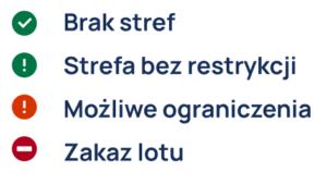
- inform about the possibility of conducting a UAV flight anywhere in Poland using a clear communicator consisting of four icons:
Note: Very important!
To function properly, the application requires the user to be registered in the PansaUTM system at utm.pansa.pl, a constant internet connection, and a valid POLISH (+48) mobile phone number at which the user must be reachable during the flight.
A stable internet connection is essential for the proper operation of the bidirectional non-verbal communication between air traffic services (ATS) and the drone pilot. This communication channel enables the following:
- Your flight area becomes visible to Air Traffic Services;
- Where required, you receive flight approval from an air traffic controller (TWR);
- You may receive notifications sent by PANSA, such as immediate flight termination commands;
- In case of a lost connection or control over the drone, you can notify ATS via DroneTower.
Check-In via the DroneTower App
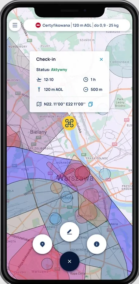
By completing a Check-In in the DroneTower app, which is an operational part of the PansaUTM system, air traffic management services can see every registered drone flight in Polish airspace. As a result, TWR controllers and FIS officers can view each Check-In on their displays and, if necessary – such as during a Medical Air Rescue (HEMS) helicopter flight – may (though are not obligated to) order or suggest (in the case of FIS) the immediate termination of a drone operation.
Through this same channel, ATS may also modify planned operation parameters, such as reducing the maximum flight altitude or shortening the duration of the flight.
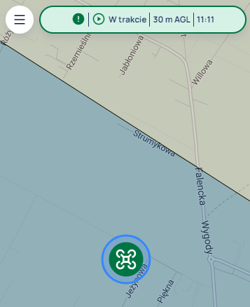
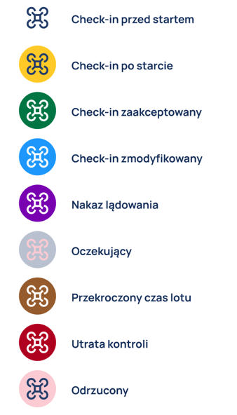
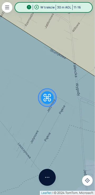
A green Check-In icon indicates that it has been accepted by a TWR (pictured) or viewed by a FIS.
Information on Geographical Zones: Checking Airspace Anywhere in Poland
Before a flight
DroneTower allows users to verify whether drone flights are permitted in a selected location in Poland before the flight. To do this, simply click on the desired location on the map. The icon located at the top of the screen will indicate whether a flight is possible in that area up to the declared flight altitude, considering the selected category, drone weight, and flight duration. Clicking on the function button, followed by the “i” button on the right, opens a window with detailed information about local restrictions, their meaning, and an assessment of flight feasibility.
Note: Airspace structures are dynamic.
The application evaluates the airspace status based on the planned time of the UAS operation and displays information only about geographical zones (e.g. DRA-R TRA, DRA-P TSA, MRT) that may be active during that period. Zone activity is indicated by the activity table included in the zone’s description (times are shown in local time!).
Important! DroneTower provides real-time information about the possibility of conducting a flight (based on the time declared in the application for the UAS operation). New zones can appear at any location and time. It is the responsibility of the drone pilot to stay informed about current restrictions. Therefore, it is normal for the application to indicate that a flight is possible in each location in the morning, but that restrictions may apply in the same location later in the day.
The application does not show information about zones planned to be activated later, except for areas designated for BVLOS flights.
Additionally, keep in mind that PANSA mainly provides information about airspace structures, but not necessarily about what exists on the ground. For this reason, DroneTower generally does not include information about ground facilities over which flying is prohibited without consent from managing entities such as seaports, power plants, water intakes, wastewater treatment plants, military units, or training grounds.
Remember! Even if you see information indicating that a flight is permitted, always verify whether there are any unpublished geographical zones or ground-based objects in the area that may impose restrictions or make the flight impossible.
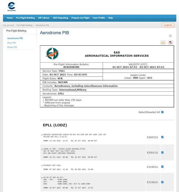
- You should check for changes in airspace that may have occurred since the mission was submitted, such as new restrictions issued in the form of a NOTAM. NOTAMs can be checked, for example, at ead.eurocontrol.int by entering the relevant aerodrome locator (Aerodrome PIB), such as EPLL for Łódź or EPWW for the Warsaw FIR, which covers the entire Polish airspace (Area PIB). Free registration is required.
- Information about aviation zones converted into geographical zones for UAS, including those introduced via NOTAM, can be obtained by calling AMC Poland at: (22) 574 57 33, (22) 574 57 34, or (22) 574 57 35.
- If no contact details for the Zone Manager are provided in the zone description, you can also ask AMC Poland for this information.
- If the flight requires additional permission, follow the instructions provided (e.g., call the area manager before takeoff and after landing).
- Obtaining consent does not relieve you of the obligation to comply with air traffic rules. The entire flight must be conducted in accordance with current regulations.
- In a geographical zone designated for a mission that is not segregated airspace, keep in mind that another aircraft, including a manned one, may appear in the area—and it must always be given the right of way.
How to use the DroneTower application
- In locations where a mission plan is not required before flight, simply perform a Check-In.
- Monitor the app. The Check-In status may change to “Accepted by ATS” – indicated by a green drone icon in the app. You may take off even if you do not receive this status update.
- In locations where a mission plan is required, you must select a previously submitted mission from PansaUTM before performing Check-In. The mission must first be approved by PANSA. For this type of operation, you may only take off after receiving clearance from the TWR controller – when the Check-In status changes to “Accepted by ATS” (green drone icon). You are not allowed to take off before that!
- REMEMBER – Your Check-In may be modified by ATS services (indicated by a blue drone icon in DroneTower), e.g., by shortening the declared flight time or reducing the AGL altitude. ATS units may also order or suggest an immediate termination of your flight – MONITOR AND ACKNOWLEDGE any messages sent via DroneTower, and FOLLOW all instructions issued through the application.
- Stick to the reported flight time. End the flight within the declared time.
- After landing, be sure to end the Check-In and verify that the drone icon has disappeared from the app.
- A TWR controller or FIS officer may contact you by phone for details about the flight – make sure your phone is always switched on and charged.
- REMEMBER – You remain responsible for the safe conduct of the flight and for collision avoidance in accordance with applicable regulations. UAV flight locations submitted via DroneTower are visible to ATS, but not to manned aviation pilots. You must always yield the right of way to manned aircraft!
Detailed information about using the DroneTower application can be found in the user manual.